Centennial Trail
in South Dakota
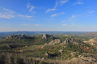
The Centennial trail is part of a 111 mile (178 km) trail that begins in Bear Butte State Park and ends at Wind Cave. The 6 mile segment (one-way) of the Centennial trail at Wind Cave is moderately strenuous and can be accesses from SD HWY 87 or from NPS 5. Here, this trail crosses through prairies, ponderosa forests, and winds along Beaver Creek.
Overnight backcountry camping is allowed in the northern areas of the park with a free backcountry permit. Please visit the visitor center to pick up your permit. More information can be found here. Hiking Safety Hiking off trail is permitted.
Watch out for wildlife. Bison and other wildlife are dangerous and unpredictable. Do not approach. Carry and drink plenty of water. There is no drinking water on this trail. Check the weather forecast before you hike.
- States
- South Dakota
- Trail type
- National Park trail
- Centroid coords
- 43.6295°, -103.4404°
About Wind Cave National Park
This trail is inside Wind Cave National Park, a national park managed by the U.S. National Park Service. Conditions, road status, trail closures, and reservation requirements are published on the park's NPS page — check it before driving in, especially in winter or during major weather events.
Official NPS trail page: https://www.nps.gov/places/centennial-trail.htm
Park homepage: https://www.nps.gov/wica/index.htm
Plan your hike
Maps + permits: long-distance trails like this often require permits for through-hiking, backcountry camping, or specific sections (especially in National Parks). Check with the maintaining organisation listed above and the relevant land manager before booking travel.
Water + supplies: water sources vary seasonally on most U.S. trails. Carry a filter and consult current trail-condition reports — through-hiker journals (PCT-L, AT Reddit, etc.) and the maintaining organisation publish regular updates.
When to go: hiking seasons vary widely with elevation, latitude, and snowpack. Through-hikers traditionally start the AT in March-April (Springer northbound) and the PCT in late April (Campo northbound). High-elevation western trails (CDT, JMT, Wonderland) generally aren't passable until July.
If you've hiked Centennial Trail and have current notes (water sources, trail closures, permit changes), tell us at /contact — we update pages as we learn.
Other trails within 50 miles
Sources
Trail data on this page is compiled from OpenStreetMap contributors (ODbL), the maintaining organisation's public-facing materials, and Wikipedia (CC BY-SA where excerpts are quoted). Distance, terminus, and descriptive text for nationally-designated trails are hand-curated from federal land-manager websites and trail-association sources. We do not modify the underlying data; this page presents what is already publicly recorded. To suggest corrections, see our methodology page.