Florida National Scenic Trail
1,500 mi long · in Florida · centroid 74 mi from Tampa
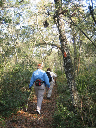
The Florida National Scenic Trail runs approximately 1,500 miles through the state of Florida, from Big Cypress National Preserve in the south to the Gulf Islands National Seashore in the panhandle. Designated in 1983, it traverses cypress swamps, longleaf pine flatwoods, and coastal ecosystems unique among the National Scenic Trails. Best hiked in winter to avoid heat and biting insects.
- States
- Florida
- Length
- 1,500 mi
- Trail type
- National Scenic Trail
- Network
- National (nwn)
- Centroid nearest city
- Tampa, FL · 74 mi · ~2.1 hr drive
- Centroid coords
- 29.0223°, -82.5095°
- Official site
- floridatrail.org
- OSM relations
- 7 sub-relations on OpenStreetMap
Termini
Southern terminus: Big Cypress National Preserve, Florida.
Northern terminus: Gulf Islands National Seashore, Florida.
Plan your hike
Maps + permits: long-distance trails like this often require permits for through-hiking, backcountry camping, or specific sections (especially in National Parks). Check with the maintaining organisation listed above and the relevant land manager before booking travel.
Water + supplies: water sources vary seasonally on most U.S. trails. Carry a filter and consult current trail-condition reports — through-hiker journals (PCT-L, AT Reddit, etc.) and the maintaining organisation publish regular updates.
When to go: hiking seasons vary widely with elevation, latitude, and snowpack. Through-hikers traditionally start the AT in March-April (Springer northbound) and the PCT in late April (Campo northbound). High-elevation western trails (CDT, JMT, Wonderland) generally aren't passable until July.
If you've hiked Florida National Scenic Trail and have current notes (water sources, trail closures, permit changes), tell us at /contact — we update pages as we learn.
Stay nearby
Sources
Trail data on this page is compiled from OpenStreetMap contributors (ODbL), the maintaining organisation's public-facing materials, and Wikipedia (CC BY-SA where excerpts are quoted). Distance, terminus, and descriptive text for nationally-designated trails are hand-curated from federal land-manager websites and trail-association sources. We do not modify the underlying data; this page presents what is already publicly recorded. To suggest corrections, see our methodology page.