Maah Daah Hey Trail
144 mi long · in North Dakota
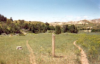
The Maah Daah Hey trail system showcases some of our country’s most unique and breathtaking terrain. Majestic plateaus, jagged peaks and valleys, large expanses of rolling prairie, and rivers.
- States
- North Dakota
- Length
- 144 mi
- Network
- Regional (rwn)
- Reference
- MDHT
- Centroid coords
- 47.0923°, -103.4746°
- OSM relation
- 11562289
Plan your hike
Maps + permits: long-distance trails like this often require permits for through-hiking, backcountry camping, or specific sections (especially in National Parks). Check with the maintaining organisation listed above and the relevant land manager before booking travel.
Water + supplies: water sources vary seasonally on most U.S. trails. Carry a filter and consult current trail-condition reports — through-hiker journals (PCT-L, AT Reddit, etc.) and the maintaining organisation publish regular updates.
When to go: hiking seasons vary widely with elevation, latitude, and snowpack. Through-hikers traditionally start the AT in March-April (Springer northbound) and the PCT in late April (Campo northbound). High-elevation western trails (CDT, JMT, Wonderland) generally aren't passable until July.
If you've hiked Maah Daah Hey Trail and have current notes (water sources, trail closures, permit changes), tell us at /contact — we update pages as we learn.
Other trails within 50 miles
Boicourt Trail
10 miles from this trail's centroid
Badlands Spur Trail
11 miles from this trail's centroid
Talkington Trail Roadside Pulloff
11 miles from this trail's centroid
Coal Vein Trail Post 1: Layers
12 miles from this trail's centroid
Coal Vein Trail Post 2: Collapse
12 miles from this trail's centroid
Coal Vein Trail Post 15: The Big Picture
12 miles from this trail's centroid
Sources
Trail data on this page is compiled from OpenStreetMap contributors (ODbL), the maintaining organisation's public-facing materials, and Wikipedia (CC BY-SA where excerpts are quoted). Distance, terminus, and descriptive text for nationally-designated trails are hand-curated from federal land-manager websites and trail-association sources. We do not modify the underlying data; this page presents what is already publicly recorded. To suggest corrections, see our methodology page.