Mountains-to-Sea Trail: Segment 7
in North Carolina · centroid 38 mi from Greensboro
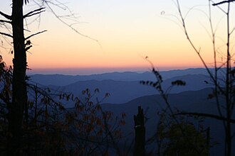
The Mountains-to-Sea Trail is a developing long distance hiking trail, which connects the Great Smokys to the Outer Banks. The trail is an official unit of the NC State Park System, and it is supported by the Friends of the Mountains-to-Sea Trail.
- States
- North Carolina
- Network
- Regional (rwn)
- Maintained by
- North Carolina Division of Parks & Recreation
- Reference
- MST
- Centroid nearest city
- Greensboro, NC · 38 mi · ~1.1 hr drive
- Centroid coords
- 36.3395°, -80.3812°
- OSM relation
- 11610837
Plan your hike
Maps + permits: long-distance trails like this often require permits for through-hiking, backcountry camping, or specific sections (especially in National Parks). Check with the maintaining organisation listed above and the relevant land manager before booking travel.
Water + supplies: water sources vary seasonally on most U.S. trails. Carry a filter and consult current trail-condition reports — through-hiker journals (PCT-L, AT Reddit, etc.) and the maintaining organisation publish regular updates.
When to go: hiking seasons vary widely with elevation, latitude, and snowpack. Through-hikers traditionally start the AT in March-April (Springer northbound) and the PCT in late April (Campo northbound). High-elevation western trails (CDT, JMT, Wonderland) generally aren't passable until July.
If you've hiked Mountains-to-Sea Trail: Segment 7 and have current notes (water sources, trail closures, permit changes), tell us at /contact — we update pages as we learn.
Stay nearby
Other trails within 50 miles
Sauratown Trail
2 miles from this trail's centroid
Mountains-to-Sea Trail: Hunting Season Detour - Segment 7
2 miles from this trail's centroid
Mountain Trail Stables Connector
3 miles from this trail's centroid
Brims Grove Connector
3 miles from this trail's centroid
RM Collins Trail
6 miles from this trail's centroid
Mountains-to-Sea Trail: Segment 8
21 miles from this trail's centroid
Sources
Trail data on this page is compiled from OpenStreetMap contributors (ODbL), the maintaining organisation's public-facing materials, and Wikipedia (CC BY-SA where excerpts are quoted). Distance, terminus, and descriptive text for nationally-designated trails are hand-curated from federal land-manager websites and trail-association sources. We do not modify the underlying data; this page presents what is already publicly recorded. To suggest corrections, see our methodology page.