Mountains-to-Sea Trail
1,175 mi long · in North Carolina · centroid 13 mi from Asheville
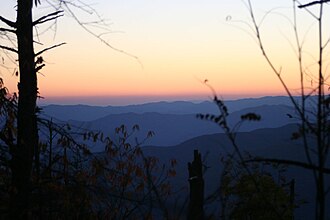
North Carolina's Mountains-to-Sea Trail runs 1,175 miles across the entire state, from Clingmans Dome in the Great Smoky Mountains to the Outer Banks at Jockey's Ridge. Designated by the state in 1977, the trail is roughly two-thirds complete and traverses the Blue Ridge Parkway, Piedmont farmland, and coastal plains.
- States
- North Carolina
- Length
- 1,175 mi
- Trail type
- Long-distance trail
- Network
- Regional (rwn)
- Centroid nearest city
- Asheville, NC · 13 mi · ~25 min drive
- Centroid coords
- 35.7106°, -82.3650°
- Official site
- mountainstoseatrail.org
- OSM relations
- 1 sub-relations on OpenStreetMap
Termini
Eastern terminus: Jockey's Ridge State Park, Outer Banks.
Western terminus: Clingmans Dome, Great Smoky Mountains National Park.
Plan your hike
Maps + permits: long-distance trails like this often require permits for through-hiking, backcountry camping, or specific sections (especially in National Parks). Check with the maintaining organisation listed above and the relevant land manager before booking travel.
Water + supplies: water sources vary seasonally on most U.S. trails. Carry a filter and consult current trail-condition reports — through-hiker journals (PCT-L, AT Reddit, etc.) and the maintaining organisation publish regular updates.
When to go: hiking seasons vary widely with elevation, latitude, and snowpack. Through-hikers traditionally start the AT in March-April (Springer northbound) and the PCT in late April (Campo northbound). High-elevation western trails (CDT, JMT, Wonderland) generally aren't passable until July.
If you've hiked Mountains-to-Sea Trail and have current notes (water sources, trail closures, permit changes), tell us at /contact — we update pages as we learn.
Stay nearby
Other trails within 50 miles
Mountains-to-Sea Trail: Segment 3
11 miles from this trail's centroid
Fonta Flora Trail
20 miles from this trail's centroid
Mountains-to-Sea Trail: Segment 4
25 miles from this trail's centroid
TRACK Trail
31 miles from this trail's centroid
Palmetto Trail: Poinsett Reservoir Passage
36 miles from this trail's centroid
Palmetto Trail: Blue Wall Passage
37 miles from this trail's centroid
Sources
Trail data on this page is compiled from OpenStreetMap contributors (ODbL), the maintaining organisation's public-facing materials, and Wikipedia (CC BY-SA where excerpts are quoted). Distance, terminus, and descriptive text for nationally-designated trails are hand-curated from federal land-manager websites and trail-association sources. We do not modify the underlying data; this page presents what is already publicly recorded. To suggest corrections, see our methodology page.