Nez Perce National Historic Trail
in Idaho · centroid 77 mi from Bozeman
The Corps of Discovery and the Nez Perce Captains Meriwether Lewis and William Clark and their Corps of Discovery traveled through Nez Perce country in the fall of 1805. After some initial apprehension, the Nez Perce embraced the expedition and provided help when the party was nearing starvation. After journeying further west, Lewis and Clark returned in the spring of 1806.
They spent more time with the Nez Perce than any other tribe encountered during their expedition. Lewis and Clark engaged in a diplomatic exchange with Nez Perce chiefs. The captains sought to establish trading posts and intertribal peace in the region.
The Nez Perce were willing to cooperate as long as guns and other weaponry were provided to the tribe. Like their Shoshone neighbors, the Nez Perce were without guns or ammunition. This left them vulnerable to their enemies who could obtain weapons from Canadian traders and also hampered their ability to hunt buffalo.
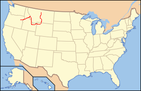
- States
- Idaho
- Trail type
- National Park trail
- Centroid nearest city
- Bozeman, MT · 77 mi · ~2.2 hr drive
- Centroid coords
- 44.5741°, -110.8229°
About Yellowstone National Park
This trail is inside Yellowstone National Park, a national park managed by the U.S. National Park Service. Conditions, road status, trail closures, and reservation requirements are published on the park's NPS page — check it before driving in, especially in winter or during major weather events.
Entrance fee: $35 per vehicle (verify current rate on the park page). An America the Beautiful annual pass ($80) covers entrance to all NPS units.
Official NPS trail page: https://www.nps.gov/places/000/nez-perce-national-historic-trail.htm
Park homepage: https://www.nps.gov/yell/index.htm
Plan your hike
Maps + permits: long-distance trails like this often require permits for through-hiking, backcountry camping, or specific sections (especially in National Parks). Check with the maintaining organisation listed above and the relevant land manager before booking travel.
Water + supplies: water sources vary seasonally on most U.S. trails. Carry a filter and consult current trail-condition reports — through-hiker journals (PCT-L, AT Reddit, etc.) and the maintaining organisation publish regular updates.
When to go: hiking seasons vary widely with elevation, latitude, and snowpack. Through-hikers traditionally start the AT in March-April (Springer northbound) and the PCT in late April (Campo northbound). High-elevation western trails (CDT, JMT, Wonderland) generally aren't passable until July.
If you've hiked Nez Perce National Historic Trail and have current notes (water sources, trail closures, permit changes), tell us at /contact — we update pages as we learn.
Stay nearby
Other trails within 50 miles
Fairy Falls Trail
3 miles from this trail's centroid
Howard Eaton Trail
17 miles from this trail's centroid
Bunsen Peak Trail
26 miles from this trail's centroid
Osprey Falls Trail
26 miles from this trail's centroid
Forces of the Northern Range Self-guided Trail
29 miles from this trail's centroid
Lost Lake Loop
31 miles from this trail's centroid
Sources
Trail data on this page is compiled from OpenStreetMap contributors (ODbL), the maintaining organisation's public-facing materials, and Wikipedia (CC BY-SA where excerpts are quoted). Distance, terminus, and descriptive text for nationally-designated trails are hand-curated from federal land-manager websites and trail-association sources. We do not modify the underlying data; this page presents what is already publicly recorded. To suggest corrections, see our methodology page.