Buffalo River Trail
37 mi long · in Arkansas · centroid 84 mi from Springfield
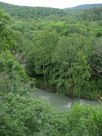
Arkansas's Buffalo River Trail follows the upper Buffalo National River for roughly 37 completed miles, the river itself being the first National River designated by the U.S. Congress. The trail crosses bluffs, hollows, and the river itself at many points and is part of the Ozark Highlands Trail system.
- States
- Arkansas
- Length
- 37 mi
- Trail type
- River-corridor trail
- Network
- Regional (rwn)
- Centroid nearest city
- Springfield, MO · 84 mi · ~2.4 hr drive
- Centroid coords
- 36.0098°, -92.9995°
- OSM relations
- 2 sub-relations on OpenStreetMap
Termini
Eastern terminus: Pruitt, Arkansas.
Western terminus: Boxley, Arkansas.
Plan your hike
Maps + permits: long-distance trails like this often require permits for through-hiking, backcountry camping, or specific sections (especially in National Parks). Check with the maintaining organisation listed above and the relevant land manager before booking travel.
Water + supplies: water sources vary seasonally on most U.S. trails. Carry a filter and consult current trail-condition reports — through-hiker journals (PCT-L, AT Reddit, etc.) and the maintaining organisation publish regular updates.
When to go: hiking seasons vary widely with elevation, latitude, and snowpack. Through-hikers traditionally start the AT in March-April (Springer northbound) and the PCT in late April (Campo northbound). High-elevation western trails (CDT, JMT, Wonderland) generally aren't passable until July.
If you've hiked Buffalo River Trail and have current notes (water sources, trail closures, permit changes), tell us at /contact — we update pages as we learn.
Stay nearby
Other trails within 50 miles
Ozark Highlands Trail
13 miles from this trail's centroid
Shine Eye to Gilbert Trail
15 miles from this trail's centroid
Old Railroad Grade
17 miles from this trail's centroid
Natural Bridge - Lost Valley Trail
22 miles from this trail's centroid
Cob Cave - Lost Valley Trail
22 miles from this trail's centroid
Eden Falls Cave - Lost Valley Trail
22 miles from this trail's centroid
Sources
Trail data on this page is compiled from OpenStreetMap contributors (ODbL), the maintaining organisation's public-facing materials, and Wikipedia (CC BY-SA where excerpts are quoted). Distance, terminus, and descriptive text for nationally-designated trails are hand-curated from federal land-manager websites and trail-association sources. We do not modify the underlying data; this page presents what is already publicly recorded. To suggest corrections, see our methodology page.