Missouri
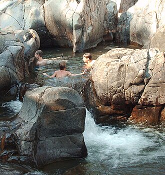
Johnson Shut-Ins
83 mi from St. Louis · ~2.4 hr drive
No height recorded
83 mi from St. Louis · ~2.4 hr drive
Johnson Shut-Ins is a named waterfall in Missouri — about 83 miles from St. Louis, MO. Full visit details below.
The exact location is at 37.5393°, -90.8380° — open in Google Maps for driving directions from your location.
Before you go: check current conditions with the appropriate land manager — state parks department, U.S. Forest Service ranger district, or National Park Service unit. Trail access, parking, water levels, and seasonal closures all vary. Several waterfalls in our database are seasonal and may run dry between mid-summer and the next rainy season.
If you've visited Johnson Shut-Ins and have current notes (parking situation, dog policy, seasonality, kid-friendliness), tell us at /contact — we update pages as we learn more.
Location and tag data for Johnson Shut-Ins comes from OpenStreetMap contributors (ODbL license) ; the Wikipedia article linked above provides additional history. We do not modify the underlying data — this page presents what's already publicly recorded. To suggest corrections, see our methodology page or contact us.