Arkaquah Trail
6 mi long · in Georgia · centroid 75 mi from Knoxville
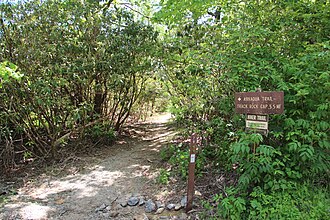
Trail descends along a ridge from Brasstown Bald parking lot to Track Rock Gap. There are ups and downs, some steep along the way. The final mile has several switchbacks. Open ridge tops provide excellent views. This trail is within the Brasstown Wildern
- States
- Georgia
- Length
- 6 mi
- Network
- Local (lwn)
- Maintained by
- Blue Ridge Ranger District
- Reference
- AT
- Centroid nearest city
- Knoxville, TN · 75 mi · ~2.2 hr drive
- Centroid coords
- 34.8767°, -83.8441°
- OSM relation
- 14619333
Plan your hike
Maps + permits: long-distance trails like this often require permits for through-hiking, backcountry camping, or specific sections (especially in National Parks). Check with the maintaining organisation listed above and the relevant land manager before booking travel.
Water + supplies: water sources vary seasonally on most U.S. trails. Carry a filter and consult current trail-condition reports — through-hiker journals (PCT-L, AT Reddit, etc.) and the maintaining organisation publish regular updates.
When to go: hiking seasons vary widely with elevation, latitude, and snowpack. Through-hikers traditionally start the AT in March-April (Springer northbound) and the PCT in late April (Campo northbound). High-elevation western trails (CDT, JMT, Wonderland) generally aren't passable until July.
If you've hiked Arkaquah Trail and have current notes (water sources, trail closures, permit changes), tell us at /contact — we update pages as we learn.
Stay nearby
Other trails within 50 miles
Benton MacKaye Trail
22 miles from this trail's centroid
Bartram Trail
28 miles from this trail's centroid
Appalachian Approach Trail
29 miles from this trail's centroid
Chattooga River Trail
32 miles from this trail's centroid
Lakeshore Trail
42 miles from this trail's centroid
Palmetto Trail: Oconee Passage
43 miles from this trail's centroid
Sources
Trail data on this page is compiled from OpenStreetMap contributors (ODbL), the maintaining organisation's public-facing materials, and Wikipedia (CC BY-SA where excerpts are quoted). Distance, terminus, and descriptive text for nationally-designated trails are hand-curated from federal land-manager websites and trail-association sources. We do not modify the underlying data; this page presents what is already publicly recorded. To suggest corrections, see our methodology page.