Mason-Dixon Trail
across 3 states · centroid 39 mi from Baltimore
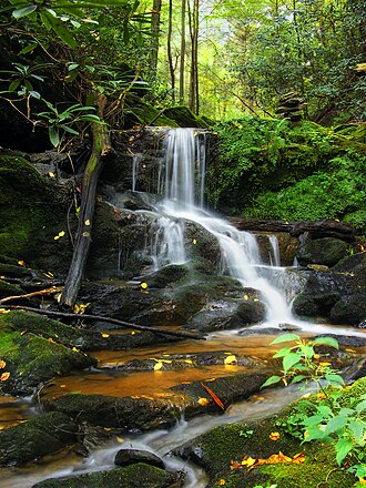
Mason-Dixon Trail is hiking trail crossing Delaware, Maryland, Pennsylvania. This page summarises what we have from public sources (OpenStreetMap and trail-association data); always verify current conditions and trail status with the maintaining organisation before heading out.
- States
- Delaware, Maryland, Pennsylvania
- Network
- Regional (rwn)
- Reference
- MDT
- Centroid nearest city
- Baltimore, MD · 39 mi · ~1.1 hr drive
- Centroid coords
- 39.8228°, -76.3644°
- OSM relation
- 1820324
Plan your hike
Maps + permits: long-distance trails like this often require permits for through-hiking, backcountry camping, or specific sections (especially in National Parks). Check with the maintaining organisation listed above and the relevant land manager before booking travel.
Water + supplies: water sources vary seasonally on most U.S. trails. Carry a filter and consult current trail-condition reports — through-hiker journals (PCT-L, AT Reddit, etc.) and the maintaining organisation publish regular updates.
When to go: hiking seasons vary widely with elevation, latitude, and snowpack. Through-hikers traditionally start the AT in March-April (Springer northbound) and the PCT in late April (Campo northbound). High-elevation western trails (CDT, JMT, Wonderland) generally aren't passable until July.
If you've hiked Mason-Dixon Trail and have current notes (water sources, trail closures, permit changes), tell us at /contact — we update pages as we learn.
Stay nearby
Other trails within 50 miles
Conestoga Trail System
15 miles from this trail's centroid
Lower Susquehanna River Water Trail
16 miles from this trail's centroid
York County Heritage Rail Trail
20 miles from this trail's centroid
Torrey C. Brown Rail Trail
21 miles from this trail's centroid
Conestoga River Water Trail
22 miles from this trail's centroid
Horse-Shoe Trail
33 miles from this trail's centroid
Sources
Trail data on this page is compiled from OpenStreetMap contributors (ODbL), the maintaining organisation's public-facing materials, and Wikipedia (CC BY-SA where excerpts are quoted). Distance, terminus, and descriptive text for nationally-designated trails are hand-curated from federal land-manager websites and trail-association sources. We do not modify the underlying data; this page presents what is already publicly recorded. To suggest corrections, see our methodology page.