Delonegha Hot Springs
26 mi from Bakersfield · ~45 min drive
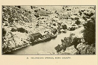
Delonegha Hot Springs is a hot spring catalogued in California by the U.S. Geological Survey's Geographic Names Information System — about 26 miles from Bakersfield, CA. Coordinates and the closest documented metro are listed below; for current access and soaking rules, check with the relevant land manager before visiting.
Safety & access
Before you go: check current conditions and access rules with the relevant land manager — National Park Service unit, U.S. Forest Service ranger district, Bureau of Land Management field office, state-park department, or the property owner if it's private. Wild thermal water can be unsafe to enter without a thermometer; surface temperatures can vary dramatically from the deeper pool. When in doubt, don't soak.
- State
- California
- Nearest city
- Bakersfield, CA · 26 mi · ~45 min drive
- Type
- Hot spring
- Coordinates
- 35.5577°, -118.6129°
- County
- Kern
- GNIS ID
- 270832
Visiting Delonegha Hot Springs
The exact location is at 35.5577°, -118.6129° — open in Google Maps for driving directions from your location.
If you've visited Delonegha Hot Springs and have current notes (parking, access, soaking rules, fees, ownership), tell us at /contact — we update pages as we learn more.
Stay nearby
Other hot springs within 30 miles
Miracle Hot Springs
5 miles from Delonegha Hot Springs
Scovern Hot Springs
9 miles from Delonegha Hot Springs
Yates Hot Springs
11 miles from Delonegha Hot Springs
Hot Springs
16 miles from Delonegha Hot Springs
Ashley Hot Spring
21 miles from Delonegha Hot Springs
Warm Spring
30 miles from Delonegha Hot Springs
Sources
Location data for Delonegha Hot Springs comes from the U.S. Geological Survey's Geographic Names Information System (public domain), feature class "Spring". We filter the GNIS Spring catalog to thermal features by name pattern (hot spring, warm spring, geyser, boiling spring, thermal). The GNIS records the geographic feature itself; access rules, ownership, and current conditions come from the relevant land manager. To suggest corrections, see our methodology page or contact us.