Long Path
358 mi long · across 2 states · centroid 34 mi from New York
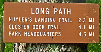
The Long Path runs 358 miles from the New Jersey side of the George Washington Bridge through the Hudson River valley and Catskill Mountains to John Boyd Thacher State Park near Albany, New York. Maintained by the New York-New Jersey Trail Conference, it was conceived in the 1930s and largely completed by the 1980s.
- States
- New Jersey, New York
- Length
- 358 mi
- Trail type
- Long-distance trail
- Network
- Regional (rwn)
- Centroid nearest city
- New York, NY · 34 mi · ~60 min drive
- Centroid coords
- 40.9397°, -74.5726°
- Official site
- nynjtc.org/long-path
- OSM relations
- 2 sub-relations on OpenStreetMap
Termini
Southern terminus: George Washington Bridge, New Jersey.
Northern terminus: John Boyd Thacher State Park, New York.
Plan your hike
Maps + permits: long-distance trails like this often require permits for through-hiking, backcountry camping, or specific sections (especially in National Parks). Check with the maintaining organisation listed above and the relevant land manager before booking travel.
Water + supplies: water sources vary seasonally on most U.S. trails. Carry a filter and consult current trail-condition reports — through-hiker journals (PCT-L, AT Reddit, etc.) and the maintaining organisation publish regular updates.
When to go: hiking seasons vary widely with elevation, latitude, and snowpack. Through-hikers traditionally start the AT in March-April (Springer northbound) and the PCT in late April (Campo northbound). High-elevation western trails (CDT, JMT, Wonderland) generally aren't passable until July.
If you've hiked Long Path and have current notes (water sources, trail closures, permit changes), tell us at /contact — we update pages as we learn.
Stay nearby
Other trails within 50 miles
Ogden Mine Railroad Trail
5 miles from this trail's centroid
Patriots' Path
7 miles from this trail's centroid
Patriots' Path
11 miles from this trail's centroid
Path to Victory Wayside
11 miles from this trail's centroid
Patriots' Path (Red)
12 miles from this trail's centroid
Stonetown Circular Trail
18 miles from this trail's centroid
Sources
Trail data on this page is compiled from OpenStreetMap contributors (ODbL), the maintaining organisation's public-facing materials, and Wikipedia (CC BY-SA where excerpts are quoted). Distance, terminus, and descriptive text for nationally-designated trails are hand-curated from federal land-manager websites and trail-association sources. We do not modify the underlying data; this page presents what is already publicly recorded. To suggest corrections, see our methodology page.