Tuscarora Trail
252 mi long · across 4 states · centroid 69 mi from Washington
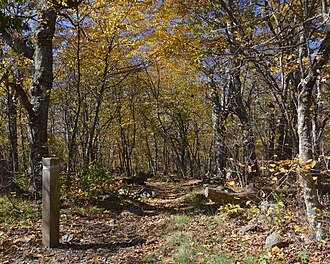
The Tuscarora Trail runs 252 miles from Shenandoah National Park through West Virginia, Maryland, and Pennsylvania, originally conceived as a relocation route for the Appalachian Trail when private-land threats made the AT's permanent route uncertain. Now a permanent trail in its own right, it offers a quieter alternative through the same Mid-Atlantic ridges.
- States
- Maryland, Pennsylvania, Virginia, West Virginia
- Length
- 252 mi
- Trail type
- Long-distance trail
- Network
- Regional (rwn)
- Centroid nearest city
- Washington, DC · 69 mi · ~2.0 hr drive
- Centroid coords
- 39.5108°, -78.0664°
- Official site
- patc.us
- OSM relations
- 2 sub-relations on OpenStreetMap
Termini
Southern terminus: Shenandoah National Park, Virginia.
Northern terminus: Pennsylvania-New Jersey state line.
Plan your hike
Maps + permits: long-distance trails like this often require permits for through-hiking, backcountry camping, or specific sections (especially in National Parks). Check with the maintaining organisation listed above and the relevant land manager before booking travel.
Water + supplies: water sources vary seasonally on most U.S. trails. Carry a filter and consult current trail-condition reports — through-hiker journals (PCT-L, AT Reddit, etc.) and the maintaining organisation publish regular updates.
When to go: hiking seasons vary widely with elevation, latitude, and snowpack. Through-hikers traditionally start the AT in March-April (Springer northbound) and the PCT in late April (Campo northbound). High-elevation western trails (CDT, JMT, Wonderland) generally aren't passable until July.
If you've hiked Tuscarora Trail and have current notes (water sources, trail closures, permit changes), tell us at /contact — we update pages as we learn.
Stay nearby
Other trails within 50 miles
Tuscalachian Loop
11 miles from this trail's centroid
ADT - Maryland - Seg 4
19 miles from this trail's centroid
Potomac Heritage National Scenic Trail
25 miles from this trail's centroid
Deerfield Nature Trail Stop 11: Japanese Barberry
32 miles from this trail's centroid
Catoctin National Recreation Trail
32 miles from this trail's centroid
Deerfield Nature Trail Stop 9: Sugar Maple
32 miles from this trail's centroid
Sources
Trail data on this page is compiled from OpenStreetMap contributors (ODbL), the maintaining organisation's public-facing materials, and Wikipedia (CC BY-SA where excerpts are quoted). Distance, terminus, and descriptive text for nationally-designated trails are hand-curated from federal land-manager websites and trail-association sources. We do not modify the underlying data; this page presents what is already publicly recorded. To suggest corrections, see our methodology page.